State of Play: The State of Damage Prevention in the UK
The LSBUD service provides people in the UK with the location of underground pipes and cables. It helps to better protect the UK’s underground infrastructure from third party damage and it keeps those working nearby safe. By joining our central system, Members are able to benefit from the ‘safety of the herd’ effect – the more asset owners who share their information through one central location, the more inquiries every utility company receives.
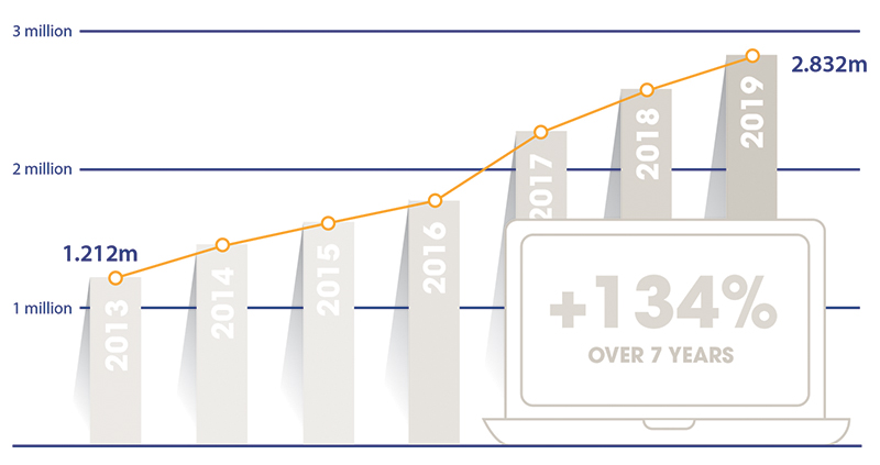
With over 2.8 million searches going through our portal in just the last 12 months, we are well placed to analyze the state of the safe digging industry, as well as discuss why the Geospatial Commission’s current focus is reinventing the wheel rather than moving the industry forward.
The Geospatial Commission
The UK government’s Geospatial Commission launched its National Underground Asset Register (NUAR) pilot trials in 2019. It is motivated to better map underground assets in order to improve safety and drive efficiencies – a worthy cause. The problem, however, is that the Commission has distorted the narrative when it comes to the safe digging industry, unfairly proclaiming it to be a disjointed community that isn’t fostering a collaborative spirit. The Commission purports to be making efforts to solve this ‘problem’, positioning itself as a pioneering body intent on establishing a more collaborative approach to “bring utility companies and Local Authorities together to share data through a single data platform for safe digging.”
The thing is nothing the Commission is doing is pioneering. It is aiming to recreate the community that is already established with LSBUD. Over 90 organizations share location data (of over 1 million km of networks) and over 120,000 registered users contribute to the three million searches that the LSBUD portal provides each year. The fact is that the majority of the UK’s underground infrastructure is registered with LSBUD.
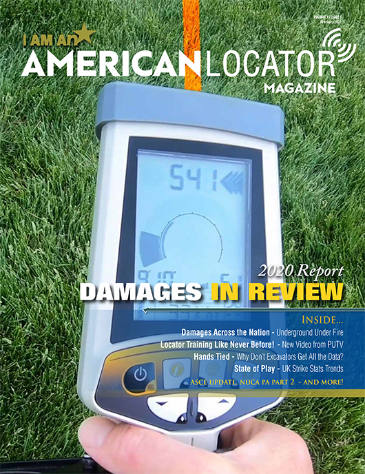
This Story is a Subscriber Exclusive.
The LSBUD service provides people in the UK with the location of underground pipes and cables. It helps to better protect the UK’s underground infrastructure from third party damage and it keeps those working nearby safe. By joining our central system, Members are able to benefit from the ‘safety of the herd’ effect – the more asset owners who share their information through one central location, the more inquiries every utility company receives.
With over 2.8 million searches going through our portal in just the last 12 months, we are well placed to analyze the state of the safe digging industry, as well as discuss why the Geospatial Commission’s current focus is reinventing the wheel rather than moving the industry forward.
The Geospatial Commission
The UK government’s Geospatial Commission launched its National Underground Asset Register (NUAR) pilot trials in 2019. It is motivated to better map underground assets in order to improve safety and drive efficiencies – a worthy cause. The problem, however, is that the Commission has distorted the narrative when it comes to the safe digging industry, unfairly proclaiming it to be a disjointed community that isn’t fostering a collaborative spirit. The Commission purports to be making efforts to solve this ‘problem’, positioning itself as a pioneering body intent on establishing a more collaborative approach to “bring utility companies and Local Authorities together to share data through a single data platform for safe digging.”
The thing is nothing the Commission is doing is pioneering. It is aiming to recreate the community that is already established with LSBUD. Over 90 organizations share location data (of over 1 million km of networks) and over 120,000 registered users contribute to the three million searches that the LSBUD portal provides each year. The fact is that the majority of the UK’s underground infrastructure is registered with LSBUD.